Wednesday, July 09, 2008

Slowing Down

There's way too much beauty to see out there and at times I have to slow down my internal need for speed mechanism so that the small, important things in this world don't pass by me unnoticed (like driving the steering wheel I found mysteriously on a hillside - now this is living life!).
From 20080706


Sometimes it takes someone to slow you down a bit...to make you realize life is about more than one's selfish desires to ride a bike constantly (that's me most of the time - a biking obsessive-compulsive-obsessive). When I do slow down I find I really enjoy many other things in life and that getting from one place to another with ultra-biking speed is not necessarily always fun (needed for stress relief, yes).
From 20080706


So this last week I've backed off the constant 80+mile rides to much slower 40-mile or less rides with some always-interesting exploration adventure along the way. I was even named Trail-Boss on a ride recently where I guided two very happy horse-crazed people on some ultra-fun trails I happen to know of. Donna (my ultimate soul-mate and forever companion) and Niki (a young, fun-loving person borrowed from a Michgan family, thanks Pat and Patti) both had a fun day as did I. Curiously though the horses could not seem to keep up with my Ellsworth super-ultra-endurance bike (the only choice of knowing trail bosses everywhere).

From 20080706


We even saw a bear this day not to mention a stubborn rattle snake that blocked the trail for the girls. I never saw it and may have simply rode over it unknowingly...wouldn't be the first time.


We've also spent some time together hiking a viewing the wild flower shows around this area.
From 20080706


Yesterday I just explored a new area on the Tucannon River side of the hill (after I climbed over the top that is) to find new areas to ride and just to see what existed out there.
From 20080708

From 20080708


To say the least I was not dissappointed in anything except the desire for more daylight and time to ride a few new areas I seem to have found, but it will be waiting for me another day.
From 20080708


From 20080708


From 20080708

Saturday, July 05, 2008

Exploring Single Track

My rides exploring at higher elevations continue as I try to escape the 100+ temps here in the valley. The temps are bad enough that I have actually driven (gasp!!! yes, I know it's so not me to drive the 20 miles up the inferno like canyons here) to the lower reaches of my favorite riding areas. I've been exploring a few of the many trails I have long ago (last year or more) marked on my GPS as "need to follow"...trails that don't exist on any map except the one in my brain and a few on my GPS.

So far all the trails have paid high in the fun-factor and huge smiles. On the "down-side" each new trail has presented additional need to explore more trails discovered along the way (oh darn). I stuggle with to stay focused on exploring one trail to its end when there are so many new, highly tempting adventures to be followed along the way. I am finding a huge network of trails and old (very old) narrow roads...which are essentially single-track trails now. Many of the trails are prime single-track (very rare around here) that are amazingly fun to ride. The trail makers are those amazingly stupid cows that have long been summer pastured in the area. They actually make some of the sweetest single-track trails.

I've had some some crazy thoughts that I can map some of these trails out and interconnect them for a long single-track ride...hmm imagine a long ride on real trails around here...a paradox to say the least. I may share my mapped out trail network with other people (if I get it done)...maybe I won't take the time to map them at all...maybe these trails will never be known to others...here is a small peak at one of the trails...oohhh yeah, the WOW factor is huge here!

Wednesday, July 02, 2008

Escaping the 100+ Heat

It's amazing what a week of warm weather will do to a snowfield that was over 100 square yards and 5-6 feet deep...just compare this pic with the one of my previous post (yes this is the same snow field). I did run into one huge snowfield (6-8 ft deep and well over a 100-yards long) that kept traffic to zero (and I like that) since it was impassable by most motorized vehicles...which means I had the entire place to myself for the most part.


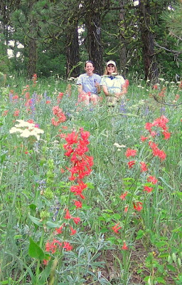
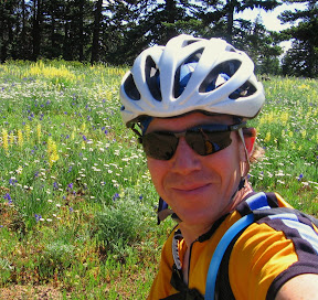
On this trip I was able to finally complete a loop. I traversed 38-miles (all up hill) to the top of S. Fork of Asotin Cr. Rd (aka Smoothing Iron Rd) for a spectacular, clear view of the Grand Ronde Canyon and the Wallowa Mtns in the distance. From there I took the rolling ridge line past the headwaters of Asotin Cr. (all three forks of it) on one side and the headwaters of the Tucannon River on the other side. Very eye-pleasing stuff that lifts the spirits. Total climbing today was about 9K for the 84-mile trek.


I'm still looking at doing a "day-ride" to Joseph, OR (~130-miles I figure) on the back roads, but the road is not quite as fast as I'd like it yet. It still has some snow on it and plenty of downed trees which don't bother me that much, except when I'm putting time constraints on the ride. I will continue to be patient...maybe.


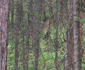
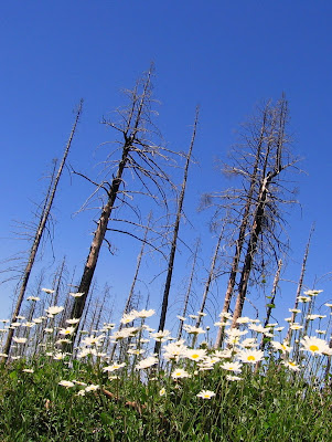
Temps on this day were 100+ in the valley which made riding up at elevation highly desireable. I saw plenty of wildlife enjoying the cooler temps up higher and signs of others that maybe did not want to be seen...like this small bear track (very small by what I have run across in Montana). Even with the nicer temps above, it was still rather warm and I ended up stopping a few time to filter some of that sweet, cool water from of my favorite spring sources.


I've had a few local inquiries as to where I ride and it seems that me pointing in the direction I ride is not enough info for anyone, so I decided to provide a profile and 3D-maps here just to clarify (or maybe confuse) the issue of where I've was on this ride.


I produced these images with a program called TopoFusion, a rather cool software developed by a mountain biking fanatic out of Arizona. I simply download my GPS data directly to the program and it produces maps and more data than I will ever need with ease. You can view his stuff at TopoFusion.com. (click on the map images for better viewing)